 Filter: Categories of Wisconsin Historical Images
Filter: FORMAT_DIMENSIONS of 45 x 40 cm.
Filter: Categories of Wisconsin Historical Images
Filter: FORMAT_DIMENSIONS of 45 x 40 cm.
| Date: | 1885 |
|---|---|
| Description: | Map of Wisconsin showing the populations of each county as well as the total population for the state. |

| Date: | 1869 |
|---|---|
| Description: | This map was engraved from original drawings and surveys taken by Louis Lipman. Includes Milwaukee street directory on the left hand side. Bottom right cor... |

| Date: | 1926 |
|---|---|
| Description: | Map shows land ownership and streets in the town of Antigo. |

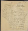
| Date: | 1947 |
|---|---|
| Description: | This map of Wauwatosa shows 10 zoning class types of land including residential, manufacturing, and business. The map also shows government buildings, some... |
If you didn't find the material you searched for, our Library Reference Staff can help.
Call our reference desk at 608-264-6535 or email us at: